VICTORIAN ODYSSEY
Caravan+RV Oct.Nov 2010
Victorians are famous for fleeing their long cold winters to go camping in the tropical north, so Tim & Ros Bowden thought this year they would head south from the Mid North Coast of New South Wales in their trusty Series 80 Landcruiser ‘Penelope’, and their camper ‘The Palace’, for an autumn tour of Victoria – and were exceedingly glad they did.
I hadn’t ever associated Victoria with volcanos, but I should have, because they have lots of them. Not big ones and mercifully not still active! – but quite recent, as it happens – some erupted as recently as 10,000 years ago and less, which is a mere blink in geological time.
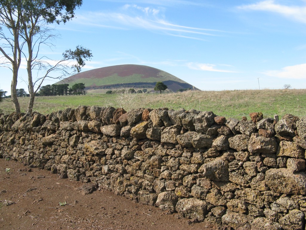
Behind a 19th century dry stone wall of volcanic stone can be seen the distinctive bulk of Mt Elephant, one of Victoria’s relatively recent (in geological terms) chain of volcanoes.
There is a great cluster of them not far west of Geelong, around the Colac Camperdown area, and more craters can be found through the Western Districts of Victoria into South Australia, where Mt Gambier’s famous Blue Lake is a spectacular example. In 2008 Victoria’s and South Australia’s volcanos were included in the international Kanawinka Global Geoparks network. So now Australia has one Geopark – joining a fairly exclusive international club. Austria has one, Brazil one also, but China has a remarkable twenty! Only eighteen nations have them, including France, Croatia, Germany, Green, Iran, Malaysia, Spain and the United Kingdom – second in the Geopark stakes after China, with eight identified there.
Roving friends had told us about the Victorian volcanos, so we certainly wanted to explore some of those, as well as re-visit the Great Ocean Road, and camp in the Grampians (which, to our shame, we had never visited).
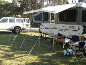
Preparations were not so arduous as a long-range northern journey where you might be away from supplies for a week or more, so I did not move Penelope’s cargo barrier forward and remove the back seat for long-term storage. We expected to be in range of shops and indeed supermarkets in closely settled Victoria. As usual we put our folding table and camping chairs behind the driver’s seat, easily pulled out for quick lunches along the road. I also chucked on a small roof rack mostly to collect wood for camp fires and camp oven roasts.
Because of time constraints, we planned to begin our Victorian travels from the west of Melbourne and leave the east of the state for another more leisurely expedition. Perhaps I was a little to cavalier in the preparation stakes, as it quickly became apparent I had not only forgotten the gas bottle for outside cooking and inside heating, but believe it or not, my camera! Fortunately Ros had hers, and a kind neighbour posted mine to Ballarat a few days later. (There were a few other absent-minded omissions as well but I don’t want to talk about them.)
Our route took us through Bulahdelah, down the Pacific Highway to Hexham, and then up the New England to Branxton where we joined the Golden Highway and a spectacular drive through some of the Wollemi National Park with rocky escarpments looking as though they might have been lookouts for bushrangers, but probably weren’t. We plunged into a network of minor roads, some sealed, some not, from Sandy Hollow to Bylong, where unsightly devastation is being wreaked on a once beautiful countryside by open cut coal mines.
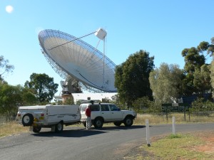
By 3.30 pm we were camped at the Goobang National Park, north of Parkes where we planned to see the famous ‘Dish’, the huge radio telescope that was a key link in broadcasting the first television pictures from the Apollo 11 moon landing in 1969. It was a chilly night too, and I said I would buy a new gas cylinder in Forbes for our heater. Ros maintained a cold silence.
Do not pass up an opportunity to visit the Parkes Radio Telescope. Its giant 64 metre wide dish (it was famously used as a cricket pitch in the movie The Dish) weighs 1000 tonnes – more than two Boeing 747s – and was built in 1961. As most people now know it was ideally situated to relay the television pictures of the moon landing during the Apollo 11 mission in July 1969. It operates 24 hours a day, receiving radio waves from outer space. There is an excellent visitor centre, where you can see movies of its past and present operations.
It is notionally possible to visit the interior of the telescope, but in our case, we would have needed to be available between 6 pm and 6 am and the public can only enter if the astronomers allow it. We did, however, fluke the time each morning when the whole ‘dish’ is rotated 360 degrees to make sure everything is working properly – an awesome sight I have to tell you. I saw a couple staging a photograph which made it look as though the young man, with his arms up, was supporting the entire telescope. I’m ashamed to say I made Ros organise that for me, even though it meant her lying on the ground to do it. Greater love hath no woman.
On to Forbes, and a most pleasant caravan park beside the Lachlan River which used to have bathing sheds for the townspeople in the 1920s, but burned down in 1930. Although it was autumn, recent rains had encouraged some out of season locusts, and I realised Penelope’s engine insect screen was yet another forgotten item of equipment. Every garage and spare parts businesses were sold out of them, of course, but a helpful fellow-camper said, ‘Why not get a $2 insect screen like I have’? A visit to a hardware store, some plastic insect screen mesh sold by the metre (or less), some gaffer tape I already had, and the engine radiator was nicely protected.
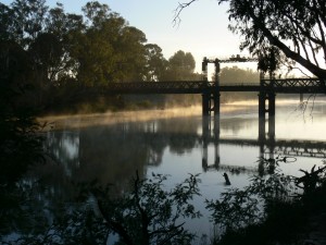
We refuelled at Tocumwal on the Murray River, then crossed over to Victoria for a great camping spot beside the river, all on our own, with fabulous views of the river as dusk fell. It was even better the next morning with a still dawn, mist rising off the river, and waterbirds cavorting and calling joyously.
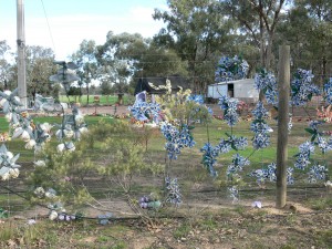
Bendigo is a very elegant old gold town, and the Regional Art Gallery is great value with a splendid collection of Australian painters, including many works by Rupert Bunny and Arthur Streeton. The local tourist literature waxed lyrical about the local vineyards and the local reds, so we went looking. The Bendigo Wine Estate was actually closed, but a nice bloke there opened up the tasting room for us, and we bought some local shiraz. He also gave us an alternative route back to our caravan park, and on the way through some scrubby country my eye was caught by a sudden riot of colour around a house in the middle of nowhere.
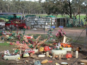
The fence was festooned with plastic flowers, and the grounds were seething with a profusion of brightly hued plastic flowers, ‘planted’ in flower beds. The entire ‘garden’ was a riot of plastic blooms, brightly coloured scarecrow statues (not that the birds would have been terribly interested), and the whole ensemble was set off against a great silver panel of discarded hub caps. We stopped to take photographs in shocked awe, and saw the owner – and presumed perpetrator of this outrage – pottering about with her dog. No need to water anything of course…
It was a short run of 120 kilometres to Ballarat, but seemed longer because of a puncture in Penelope’s driver’s side rear wheel. Managed to pull up safely, and changed the tyre in cheerless drizzling rain.
We camped at the Ballarat Goldfields Holiday Park, within walking distance of the Sovereign Hill historic gold mining site, and found the whole experience extremely rewarding, particularly the old steam engines and huge beam operated pumps that were in working order.
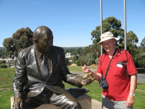
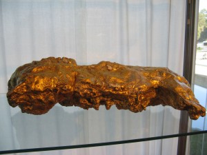
Fired with tourist zeal we beat a path to the Gold Museum, close by, with its models of the enormous nuggets discovered near Ballarat and elsewhere and some splendid interpretive photographs and other displays of social history. Just outside the museum I saw a life-sized bronze statue of that dreadful old crook, Sir Henry Bolte, who while Premier of Victoria helped finance the Gold Museum. He had one arm held out in an irresistible gesture, and I (and doubtless many others) responded appropriately for the camera.
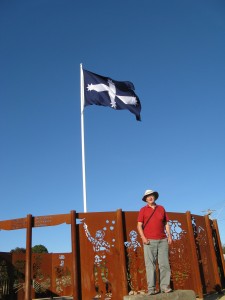
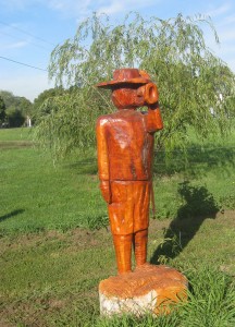
It was time for the volcanos, and we drove towards Camperdown and Lake Purrumbete, a volcanic lake full of succulent trout and other freshwater fish, where we intended to camp for two days to explore some of the many local craters nearby. As we drove through the hamlet of Smythetown, south of Ballarat, I glimpsed a charming little war memorial, complete with freshly carved wooden statue of a digger sounding a trumpet.
Unmistakably our first volcano, Mt Elephant, loomed up as we neared Skipton. But it was shut. With some anticipation (because you could see a track to the top of the dome) we drove up to the gate to read that Mt Elephant was only open to visitors from 1 – 6 pm on the first Sunday of every month! Fortunately there were many other volcanos more regularly available. A consolation prize was a superb example of a dry stone wall, built of volcanic rocks, dating back to the 19th century, with Mt Elephant in the background.
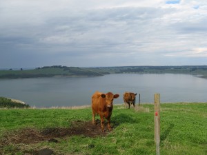
Lake Purrumbete has a beautifully situated caravan and camping ground beside the water, and the surrounding grass happened to be bursting with mushrooms which provided us with a free lunch fried with bacon, on toast. Being a volcanic lake, there is no run off from the surrounding countryside, but the lake is refreshed and replenished by underground aquifers.
The following day we decided to circumnavigate (by land) Victoria’s biggest lake, Lake Corangamite, which is not volcanic in origin, but super-saline, covering some 230 square kilometres. Surprisingly is also Australia’s largest permanent saline lake. Our loop ran from Camperdown north-east to Cressy (on the Hamilton Highway) and south through Beeac to Colac (on the Princes Highway) and back to Camperdown.
At Camperdown it is possible to drive up Mt Leura on a good bitumen road to the top, with fabulous views and good excellent information on the eruptions that caused the many craters and conical peaks we could see from the summit. We drove down and to the west of the town, up a rise (through a caravan park) to view two adjoining crater lakes separated by less than 200 metres. One, Lake Bullen Merri is merely brackish, the second, Lake Gnotuk, is twice as saline as salt. An added bonus was a walk around a small botanical garden started in the 19th century.
Far from volcanoed out, we sampled another at Red Rock, near Lake Beeac on the southward leg from Cressy to Colac. Again, there were excellent views of the unique volcanic landscape. This time our added bonus was a small winery at the base of Red Rock, where the genial owner offered some good advice on the now ubiquitous metal Stelvin caps that have replaced corks on wine bottles. They keep the wine safer than corks, but it is ESSENTIAL to open a red at least 30 minutes before drinking – 15 minutes if decanting – otherwise the flavours don’t interact with oxygen. The winemaker said that if you taste the wine immediately it is opened, and then again (if you can hold off that long) half an hour later it will taste like a different, superior wine.
We decided to pick up the Great Ocean Road at Lorne, even though this meant retracing our route to a certain extent, but the distances are so small we didn’t mind. Before tackling the mountains of the Angahook Lorne State Park we passed through Deans Flat, where a local sculptor has created remarkable figures from the multi-faceted stumps of three old pine trees.
Driving the Great Ocean Road is always exciting in two ways, the physical improbability of this iconic scenic drive, and the concentration needed to navigate your camper or caravan around all those sharp bends. The first labourers on what was destined to be a memorial to those who died in World War I, were the returning diggers themselves. Swapping rifles and explosives for a pick and shovel and dynamite was hardly rich pickings from a grateful nation, with horse-drawn carts the only ‘heavy machinery’ on offer. The entire road from Barwon Heads to Warrnambool wasn’t finished until 1932.
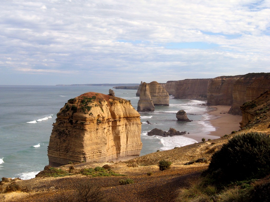
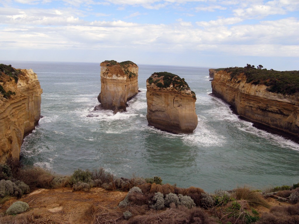
Some of the ’12’ Apostles on the Great Ocean Road. One, to the right of the big sandstone monolith, had recently crumbled and fallen into the sea.
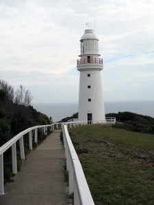
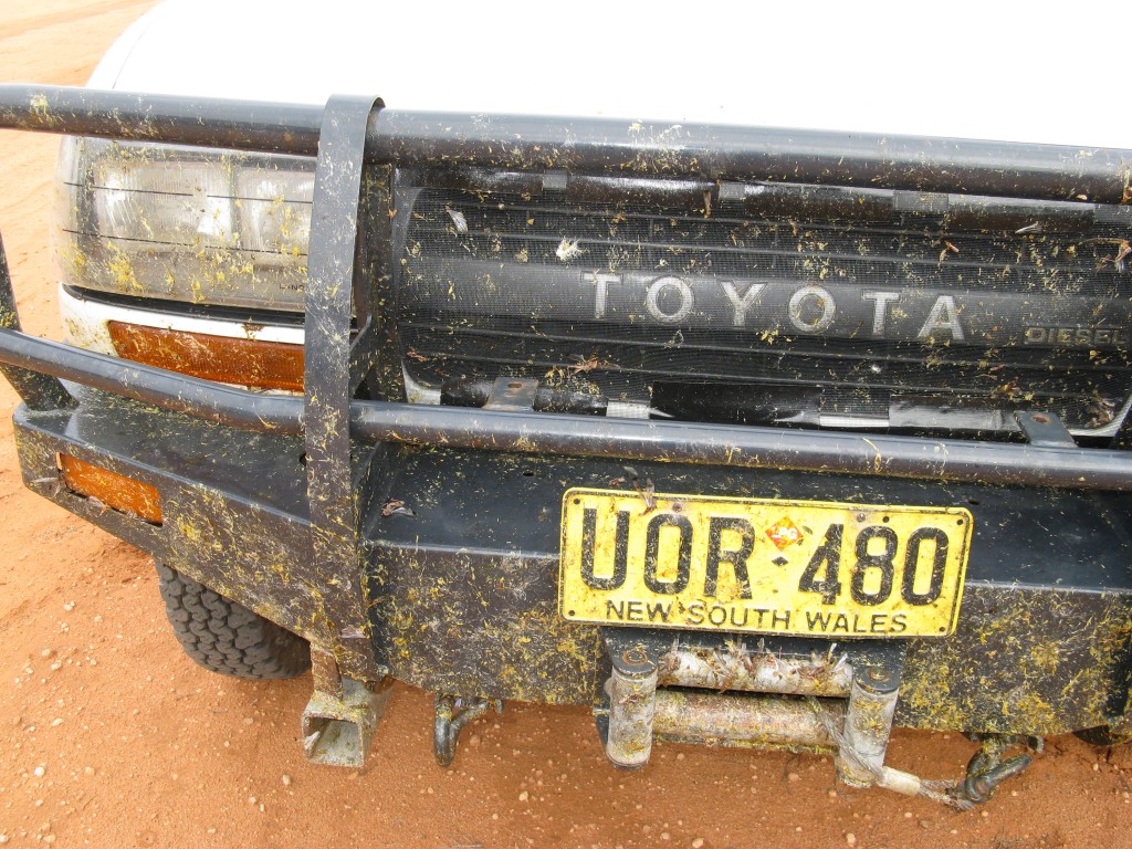
Pulling off from time to time at cliff-side stops for photographs and a reviving coffee from the thermos, we ground our way round and about those near vertical cliffs until we entered the Cape Otway National Park, hoping to camp as near as possible to the lighthouse there, and found a great waterfront location in the national park to the east of the lighthouse, slightly tarnished by the remarkable numbers of European wasps about, which fortunately devoted most of their attention to the carcasses of the squashed locusts on Penelope’s bull bar and improvised $2 mesh insect screen. That night I tested our recently purchased broadband 3G modem, and had the luxury of checking and responding to our emails in that remote coastal location – and catching up with a weather forecast that was mercifully quite favourable.
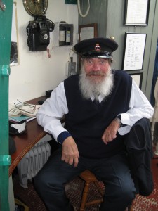
This rugged south coast of Victoria has been the graveyard of thousands of ships, which was why Cape Otway was the first permanent lighthouse built on mainland Australia, established in 1848. We spent a happy couple of hours wandering about the complex the next morning with its lightkeepers’ cottages and Telegraph Station. Climbing the light we met Pat Howell, a real-life lighthouse keeper, formerly from the Gabo Island light, but displaced when the Federal Government made all lighthouses automatic in the 1990s. Dressed in his natty blue uniform, the grey-bearded Pat agreed that he was an endangered species. I was amazed that the wonderful 19th century lamp with its crystal prisms at Cape Otway was no longer used – unlike the Eddystone Point light on the north-east coast of Tasmania, still shining and revolving using its original clockwork mechanism dating back to 1888.
‘So where is the light coming from now’? I asked Pat. He pointed down to a miniscule little structure barely visible over the surrounding bushes at the base of the tower. Apparently new technology gave this pathetic little flashing gizmo enough power to duplicate the reach of the old, now defunct light. I thought it a horrible failure of heritage not to keep the original perfectly crafted light operating. Pat agreed, but shrugged and said it was cheaper to do it the other way and that was that.
I was amused by an account of the first Cape Otway Lightkeeper, one Lieutenant Lawrence, sacked from his position after only a few months on the job. The official reason was that he made repairs he wasn’t qualified to do. The real reason was, however: ‘His foul mouth, penchant for the rum and all round ungentlemanly conduct.’
Shipwrecks were on our mind when we walked to the wild and beautiful coastline at the Twelve Apostles lookout near Port Campbell. The numbers of these seemingly sculptured sandstone pinnacles are dwindling, as the relentless erosion of wave action erodes their bases – but then again, nature is undoubtedly manufacturing more as the cliffs behind them are inevitably weathered. Close by are the lonely graves of several victims of the wreck of the clipper Loch Ard, on 1 June 1878. The only survivors were a ship’s apprentice, Tom Pearce, and a non-swimming passenger, Eva Carmichael (18), who clung to a chicken coop and was rescued by Tom. The other 52 people on board were killed as the 1693 tonne iron-hulled cargo clipper was smashed against the rocks and cliffs of this fractured coast. Loch Ard Gorge is spectacularly beautiful on a clear sunny day, but must have been terrifying in bad weather and at night.
We camped at Warrnambool in time to go out to dinner for our 42nd wedding anniversary at an excellent restaurant, Donnellys, which produced a crayfish risotto to die for – which the resident Type 2 diabetic might well have, judging by his blood sugar readings the next morning. Entirely my own fault of course – I should have passed on the crème brule.
The Flagstaff Hill interactive Maritime Village and Museum replicates a 19th century port with historic wooden boats moored near its wharf. We particularly wanted to see the famous porcelain peacock, 1.5 metres tall, and miraculously saved from the wreckage of the Loch Ard, which was on its way to the Melbourne International Exhibition of 1880. Its crate somehow made it to shore undamaged, except for a small piece of the peacock’s beak which had been chipped off, and (sadly in my view) restored in the 20th century so that it now seems perfect. Reportedly insured for $4 million, the highly decorated and floodlit patched-up bird now revolves slowly in its purpose-built glass case.
We were not yet quite finished with volcanoes, and camped at Nelson, a fishing port close to the South Australian border. We planned a day trip to Mt Gambier, just over the border, without towing our camper, The Palace, to avoid the horrendous but necessary quarantine rules in South Australia which would have seen all our fruit and veggies confiscated.
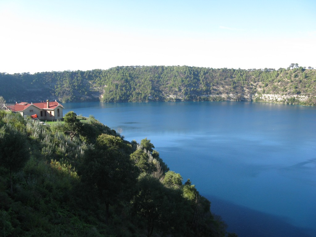
Flagged as one of the most significant volcanos within the Kanawinka Global Geopark, the Blue Lake is the biggest crater lake of those in the three maar craters formed very recently – about 4500 years ago. It is world famous because of the curious phenomenon that takes place over two days each November, when the already blue waters of the lake turn a stunning turquoise blue. Debate still continues on how and why this happens. This vivid blue does fade as the year progresses, but was still spectacular when we were there in April. The Blue Lake is fed by underground aquifers, and the limestone filtered water provides Mt Gambier’s water supply.
The weather was looking iffy as we retraced our steps to Nelson, packed up and drove north through thick pine forest plantations to Dartmoor and on to Hamilton and Dunkeld, before entering The Grampians National Park from the south. Most of the driving was on the flat, with mountains rearing up on either side, while clouds continued to build and it began to rain. The rain eased as we arrived in the Halls Gap area and we managed to camp between showers at Borough Hut Camp, just to the south of the Halls Gap town. We realised it was a long weekend, as the camping area quickly filled up and we were lucky to get a good location for our three night stay. It rained consistently through the night making conditions uncomfortable for a shoal of teenage boys from a Police Boys Club who pitched their frail tents in the dark. They set off for an overnight camp elsewhere in the park after breakfast, just as the rain set in again.
We thought we might have to break out the DVD player, but mid morning the sun broke through and we drove through Halls Creek and into the mountains to a viewing spot now called The Balcony, but used to be known as the Devil’s Jaws because of a jutting rock feature where people used to climb in to be photographed, but is now fenced off. Rain swept in again as we got back to Penelope and we abandoned out planned walk to Mackenzie Falls and drove down the mountain back to camp along a one-way narrow track past Silverband Falls which we hoped to get to in drier weather.
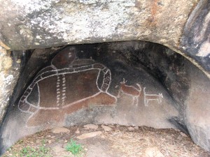
Aboriginal custodians re-touched the paintings in Bunjil Cave after they were defaced by vandals in the 1960s.
The sun reappeared after lunch and we drove east, through Pomona, to see the Bunjil Cave, where an image of the Dreamtime creator of the area had been painted. When we got there we found the cave locked up behind a horrible wire cage. Apparently vandals got in there in the 1960s and tried to wipe the painting off the cave wall! The painting has since been re-touched by the Aboriginal custodians and locked away from idiots.
Another rain squall swept in as we drove back to camp in time to see a sodden string of the Police Boys Club lads walking in, having had to abandon their plan to camp out. They looked exhausted and we wondered if they had a dry change of clothes in their tiny tents.
Despite the rain our obliging neighbours had kept a camp fire going, and we were able to use our camp oven for a roast dinner of rolled shoulder of lamb with kumera, potatoes, onions and green peas (cooked on the stove). A glass or three of red seemed to hit the spot.
The Lord granted us a fine day next morning and we retraced our route to walk to Mackenzie Falls, and then started to descend from the Grampians high country to the Zumstein Picnic Area to the west, on the former property of a German bee-keeper, Walter Zumstein, who first came to the area after the World War I (presumably he wasn’t fighting for the Allies!) and eventually married a Scottish lady whom he brought to the Grampians in the post World War II years. His rammed earth house and outbuildings still stand, and there are some good stories told about this engaging German and his Model T Ford to be read on the information boards.
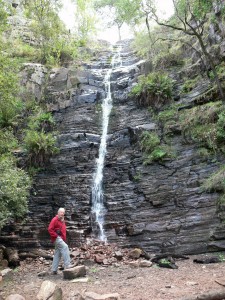
Driving back to camp we were at last able to walk to the Silverband Falls, which are fairly modest as falls go, but unique in that the water disappears underground as soon as it hits the rocks at its base. You can actually stand a metre in front of the base of the falls and not be splashed while taking a photo. The water reappears several hundred metres down the valley.
With the weather still holding up, we drove up Mt William, the highest peak in the Grampians (1167 metres) in the late afternoon for some great views of the park, and made a resolution to return at another time for a more thorough exploration of this delightful and varied national park.
It was time to head home, and we tracked north to Mildura to cross the Murray River again and head for the Mid North Coast of New South Wales. Now I have to say that although our $2 insect screen saved the radiator from locusts, the front of Penelope was well and truly plastered with those pesky hoppers, which I discovered when we got home, seem to have their stomachs filled with yellow Araldite. No cleansing preparation I could find had any effect on them at all! A non-scratch scouring sponge, detergent and elbow grease was the best I could do, and it was a day’s work to get 90 per cent of the mess off. And this was autumn too when the little munchers are supposed to be still in the ground.
I will go camping again, I will, I will…

